A major storm system is lifting into Canada, bringing heavy rain, thunderstorms, and gusty winds to the Northeast on Friday.
The storm system caused 11 confirmed tornadoes across Texas, Louisiana, Mississippi, Alabama, Florida, and North Carolina. Fortunately, the worst of the rain has passed for the Interstate 95 corridor, and only scattered showers are expected throughout the afternoon.
A wind advisory has been issued from Maine to Georgia, with gusts near 50 mph expected for some areas on Friday. Flood and wind alerts are in effect for the eastern U.S., spanning from the Great Lakes to the Carolinas and up to Maine.
Friday afternoon is expected to bring gusty winds, with some higher elevations in New England possibly experiencing gusts of up to 55 mph. These gusty winds are expected to continue into Saturday. A tornado with wind speeds reaching up to 100 mph, classified as an EF-1, caused damage near St. Augustine, Florida on Thursday.
Over the past 24 hours, the states from Florida to West Virginia have experienced not only tornadoes but also a staggering 77 reports of damaging storms. Specifically, North Carolina and Virginia encountered wind gusts reaching speeds of 58 to 68 mph.
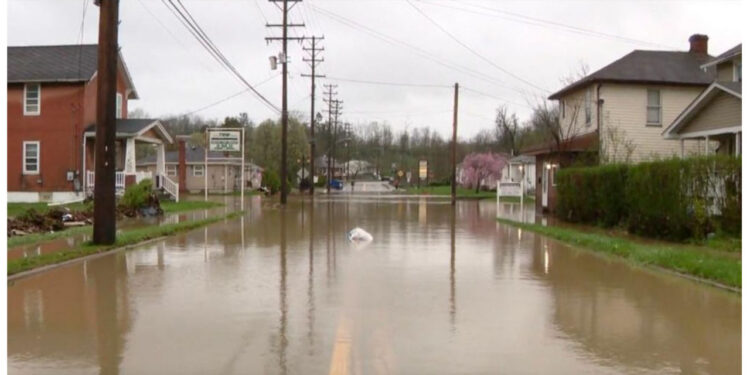
A flash flood emergency was declared on Thursday evening in the vicinity just west of Pittsburgh, as an astonishing 4 inches of rain poured down within a few hours. The Pittsburgh metro area witnessed numerous water rescues during Thursday night.
Pittsburgh is experiencing the wettest start to any month on record. Over the past 11 days, the city has received a staggering 7 inches of rain.
In Charleston, South Carolina, heavy flooding caused dozens of roads to close in the downtown area on Thursday. The city experienced an unprecedented amount of rainfall, with a record-breaking 3.23 inches in a single day.

